Welcome to The Old Map Shop!
Continue Shopping
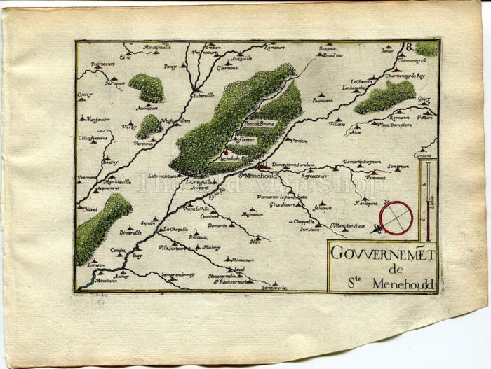
This rare antique 1634 Nicolas Tassin Map of Sainte-Menehould, Auzeville, Marne, Champagne-Ardenne region of France is from Nicolas Tassin's Les Plans et Profiles De Toutes Les Principales Villes et Lieux Considerables de France.
TITLE: This Tassin map is Titled 'Gouvernemet de Sainte-Menehould'
DATE PRINTED: 1634 so is over 370+ years old.
SIZE: Map area approx 15 x 10.5 cm's on a page 19.5 x 15 cm's.
CONDITION: Very good for its age. Bottom corner or margin has been cut off but does not affect the map area as can be seen. I would consider a better copy almost impossible to find. This is the first edition so is a strong impression. The reverse side of page is blank.
ADDITIONAL COMMENTS: Please note that this is a rare antique map by Nicolas Tassin & was actually printed in 1634. This is not a modern reproduction. This map has fine attractive modern hand colour. The hand colouring is recent and has been professionally applied by us using the finest watercolours.
Copyright © 2016 The Old Map Shop. All Images & Text in this listing are Copyright. No reproduction allowed without permission. Furthermore although this rare antique map is for sale the reproduction/image rights to this map/image themselves are not for sale or transferable after sale they remain with The Old Map Shop. This means that once in your possession you may not reproduce this map on the internet or any printed, digital or electronic form without permission.
STOCK CODE: TassinC-057
Thank you.