Welcome to The Old Map Shop!
Continue Shopping
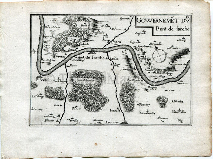
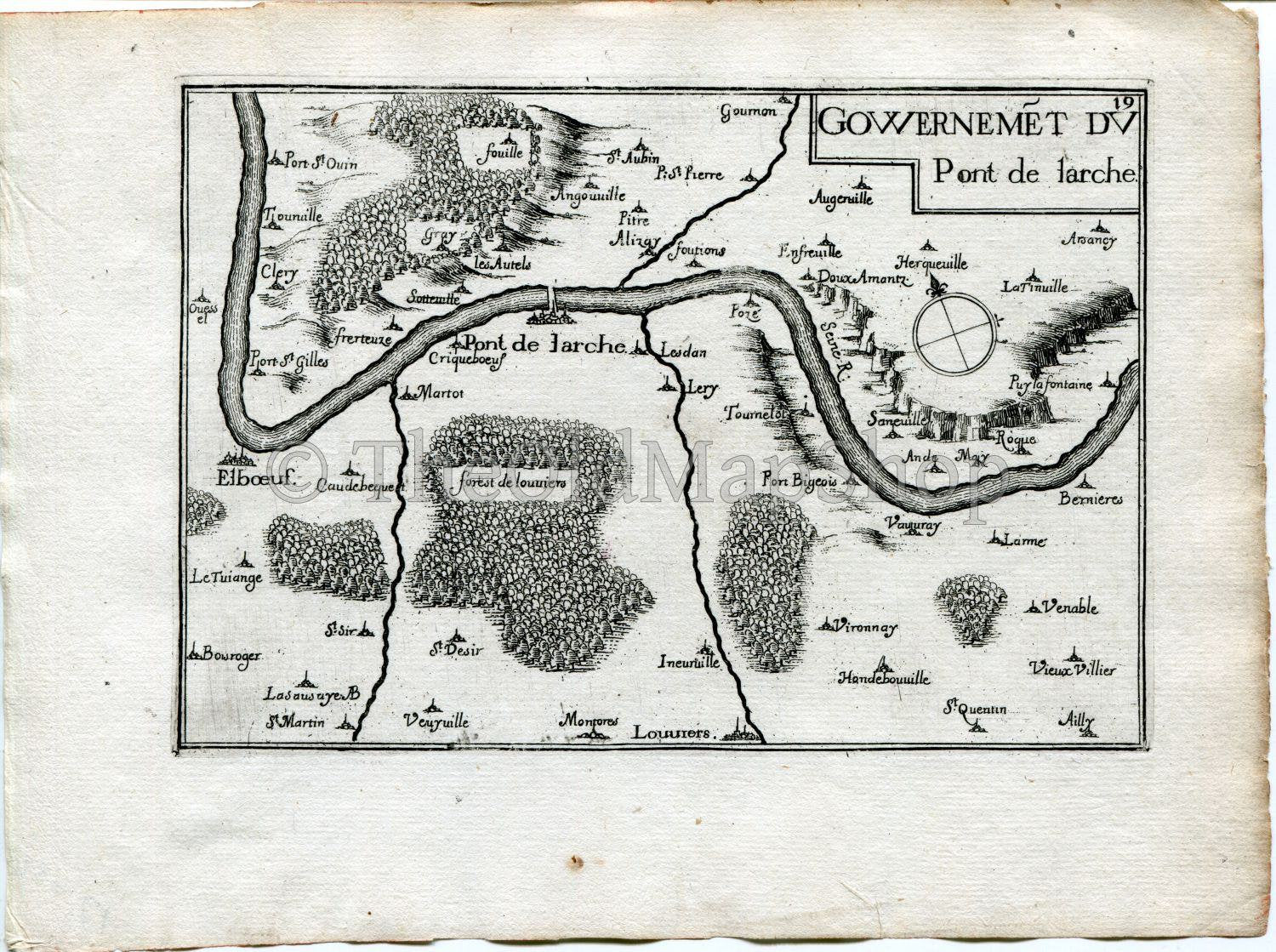
This rare 1634 Nicolas Tassin Antique Map, Pont-de-l'Arche, Alizay, Elbeuf, Louviers, Poses, Oissel, Lery, Ande, Eure, Normandy, France Carte, Print is from Nicolas Tassin's Les Plans et Profiles De Toutes Les Principales Villes et Lieux Considerables de France.
TITLE: This Tassin map/print is Titled 'Gouvernemet du Pont-De-Larche'
DATE PRINTED: 1634 so is over 370+ years old.
SIZE: Print area approx 15 x 10.5 cm's on a page 19.5 x 15 cm's.
CONDITION: Good for its age. As with all old maps/prints there may be minor imperfections. I have shown a very detailed scan so that any marks/creases can be easily seen....Please study both scanned images for all details.
The watermark has been digitally added and will not appear on the map/print you receive.
STOCK CODE: Tassin-170
Thank you.