Welcome to The Old Map Shop!
Continue Shopping
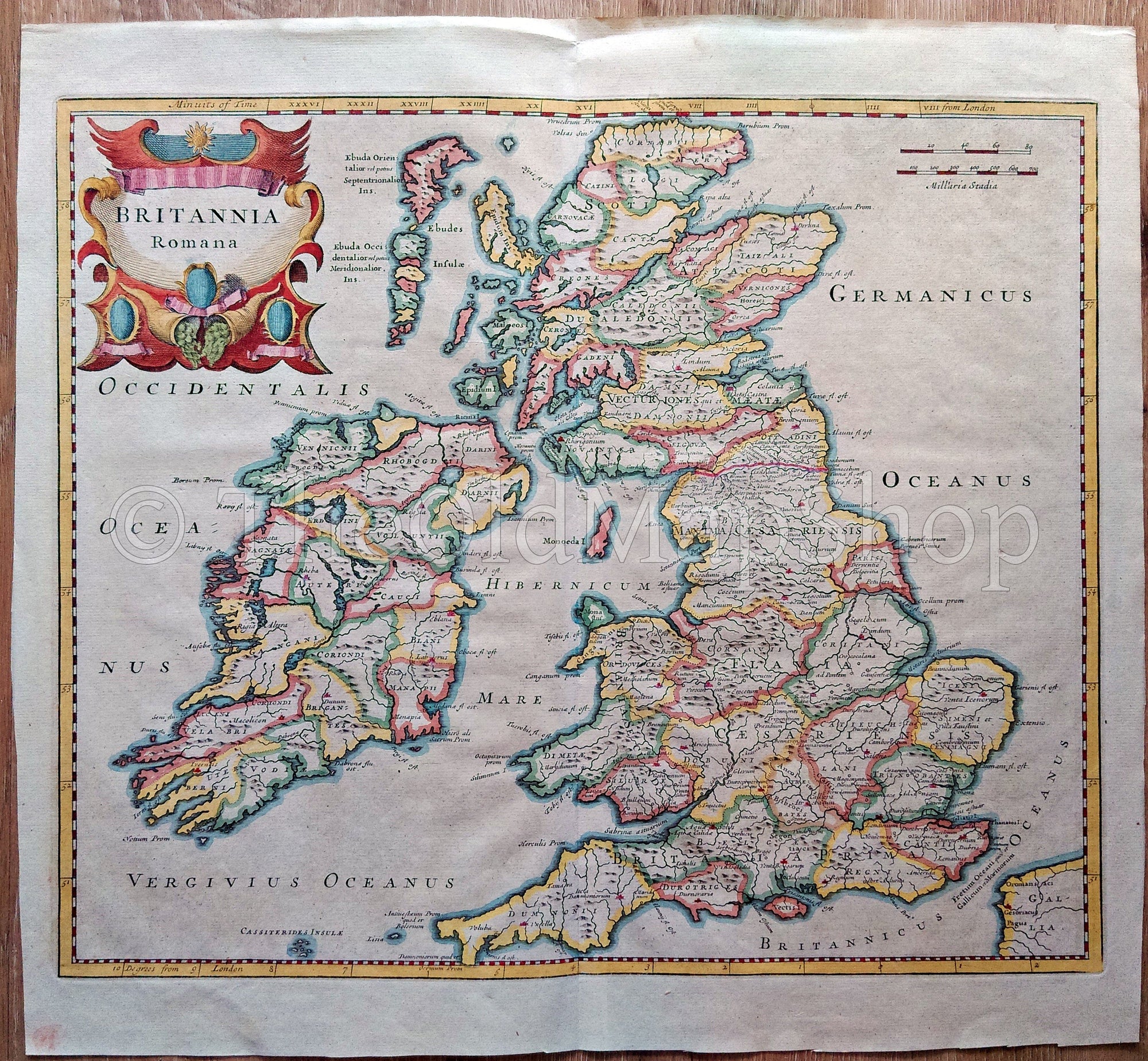
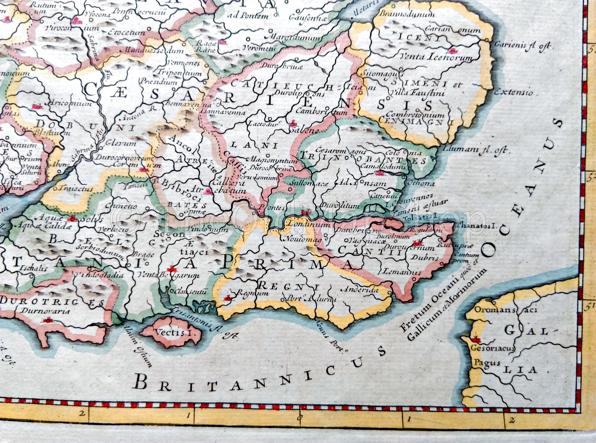
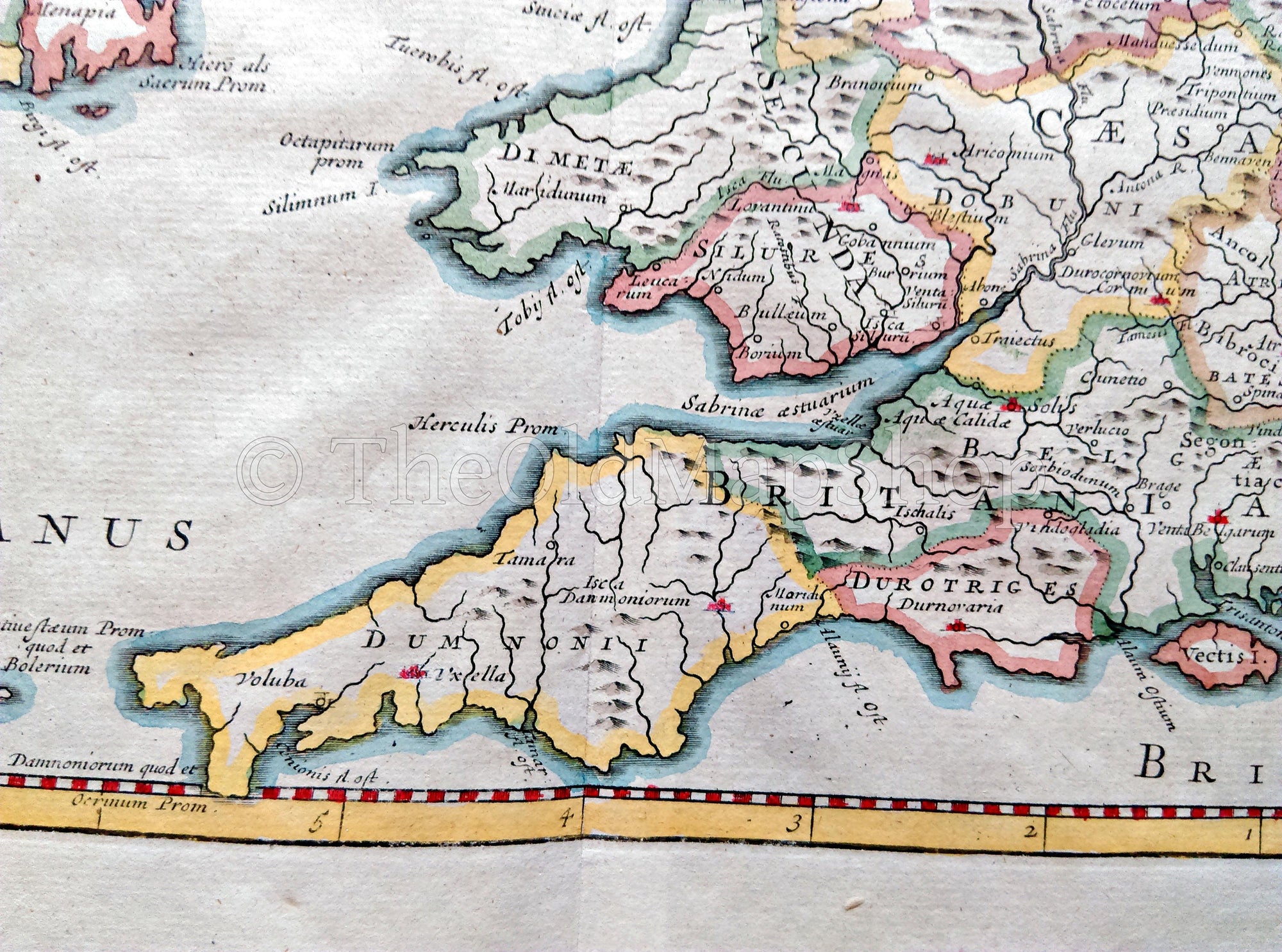
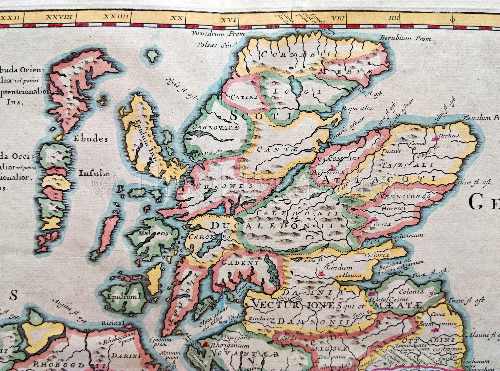
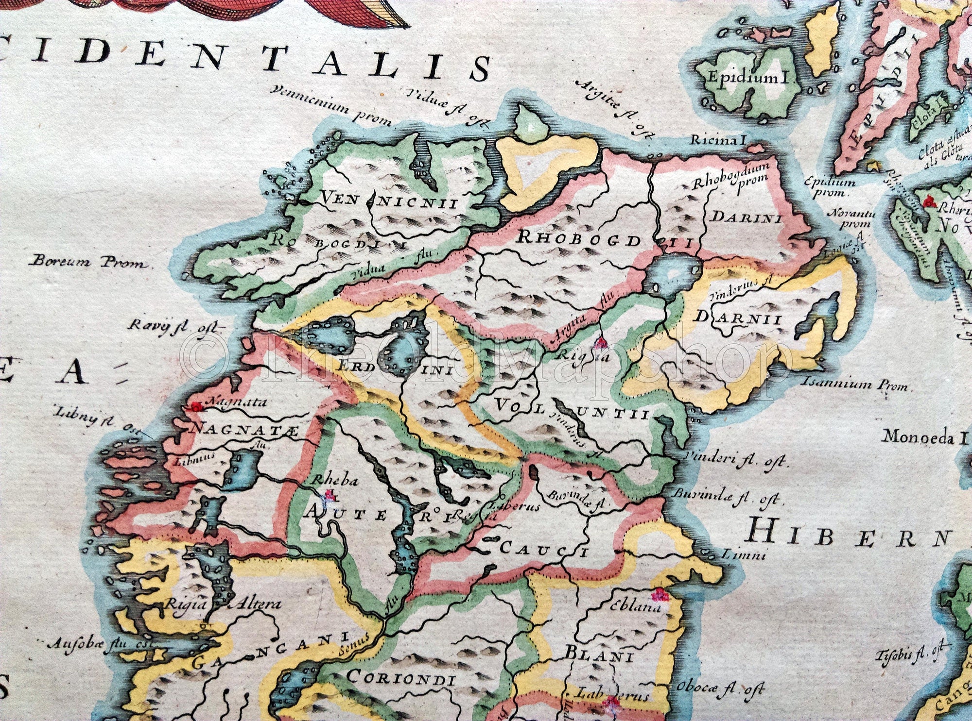
1722 Britannia Romana Antique Map by Robert Morden - Roman Britain, England, Ireland, Scotland, Wales, From Camden's Britannia
There is one fold in the middle where it was folded into the Atlas. This is a hand colored copperplate engraving with later coloring. The last photo shows the reverse side of this folding map.
CARTOGRAPHER: Robert Morden
TITLE: Britannia Romana.
DATE PRINTED: 1722 in Camden's Britannia.
SIZE: The full page is approx. 16.5 x 18 inches, or 42 x 45.5 cm's
CONDITION: For its age this map is in wonderful condition. NO holes, tears staining etc.... as would be expected from a map this old. I doubt you would find a better copy of this map. Please study the detailed photos for condition before purchasing. Thank you.
Please Note: The watermark has been digitally added and will not appear on the map you receive.
Shipping: This map will be posted rolled in a postal tube for greatest protection..
Thank you.