Welcome to The Old Map Shop!
Continue Shopping
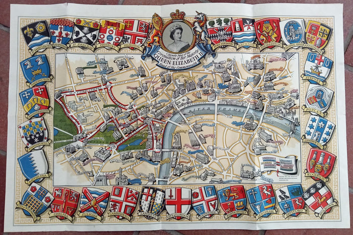
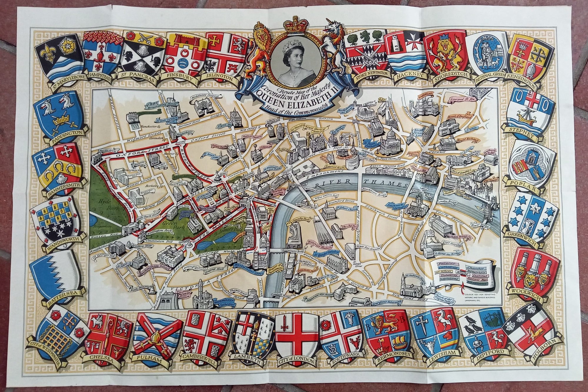
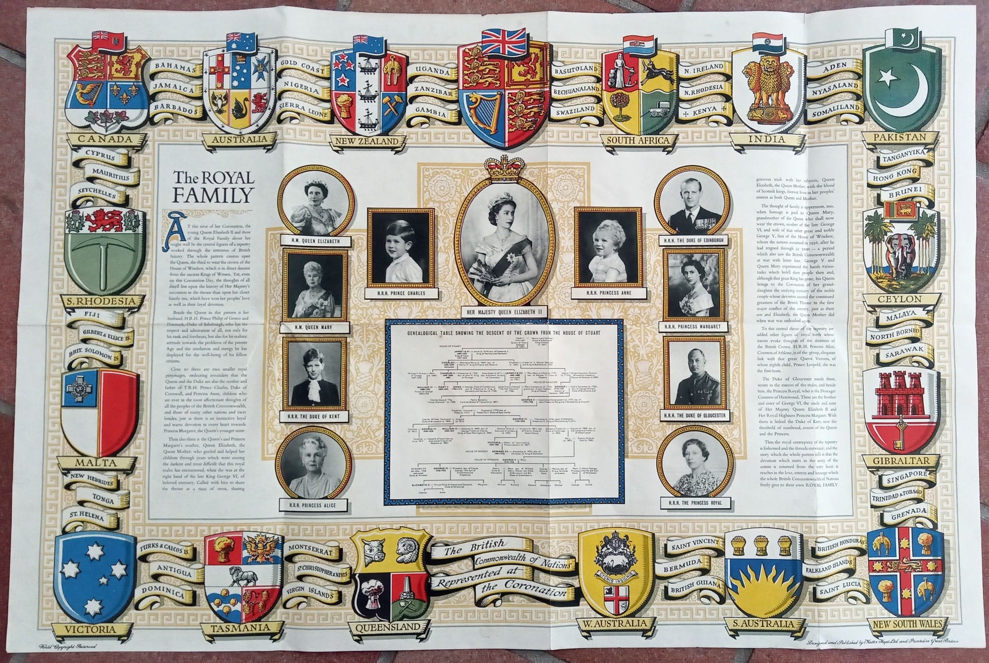
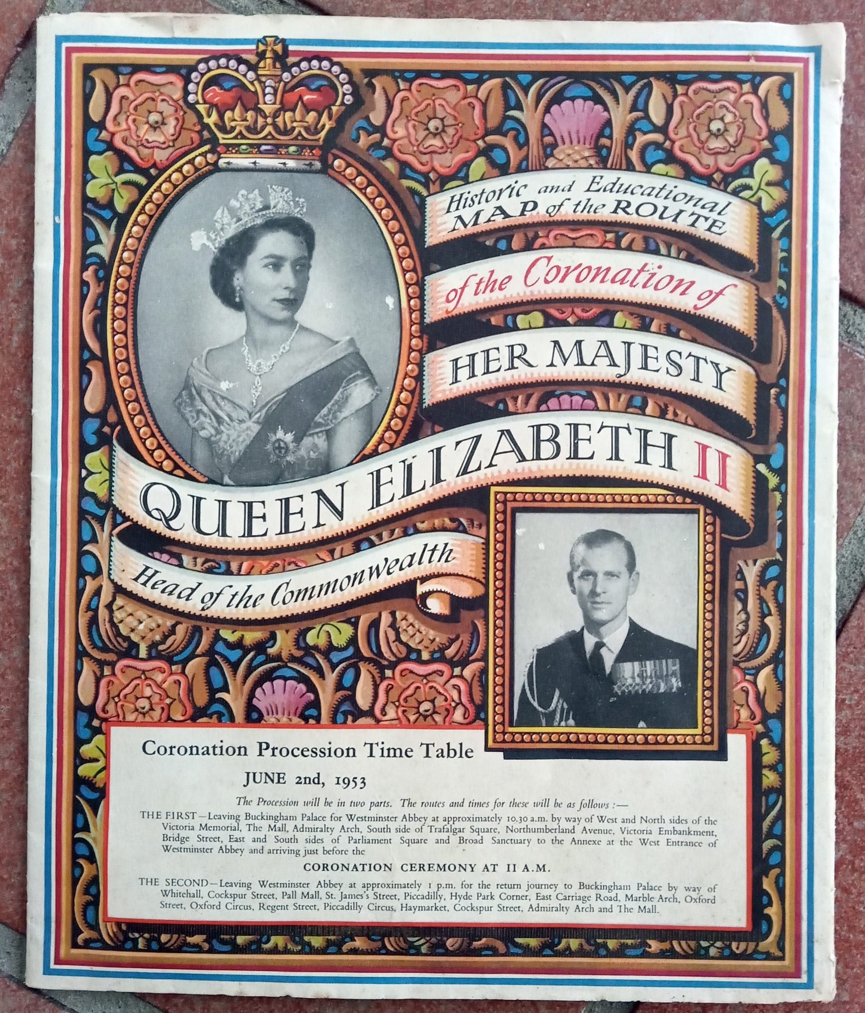
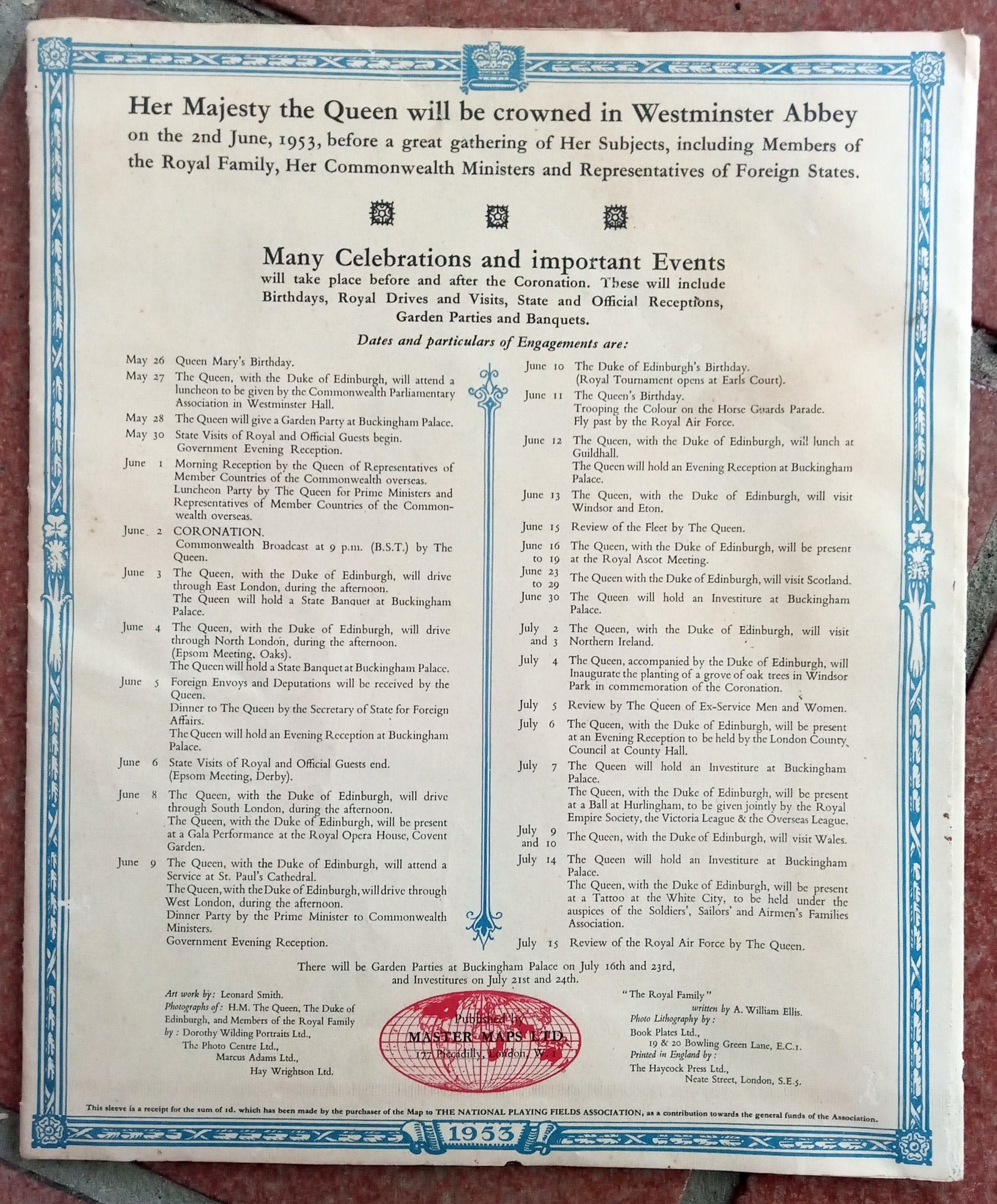
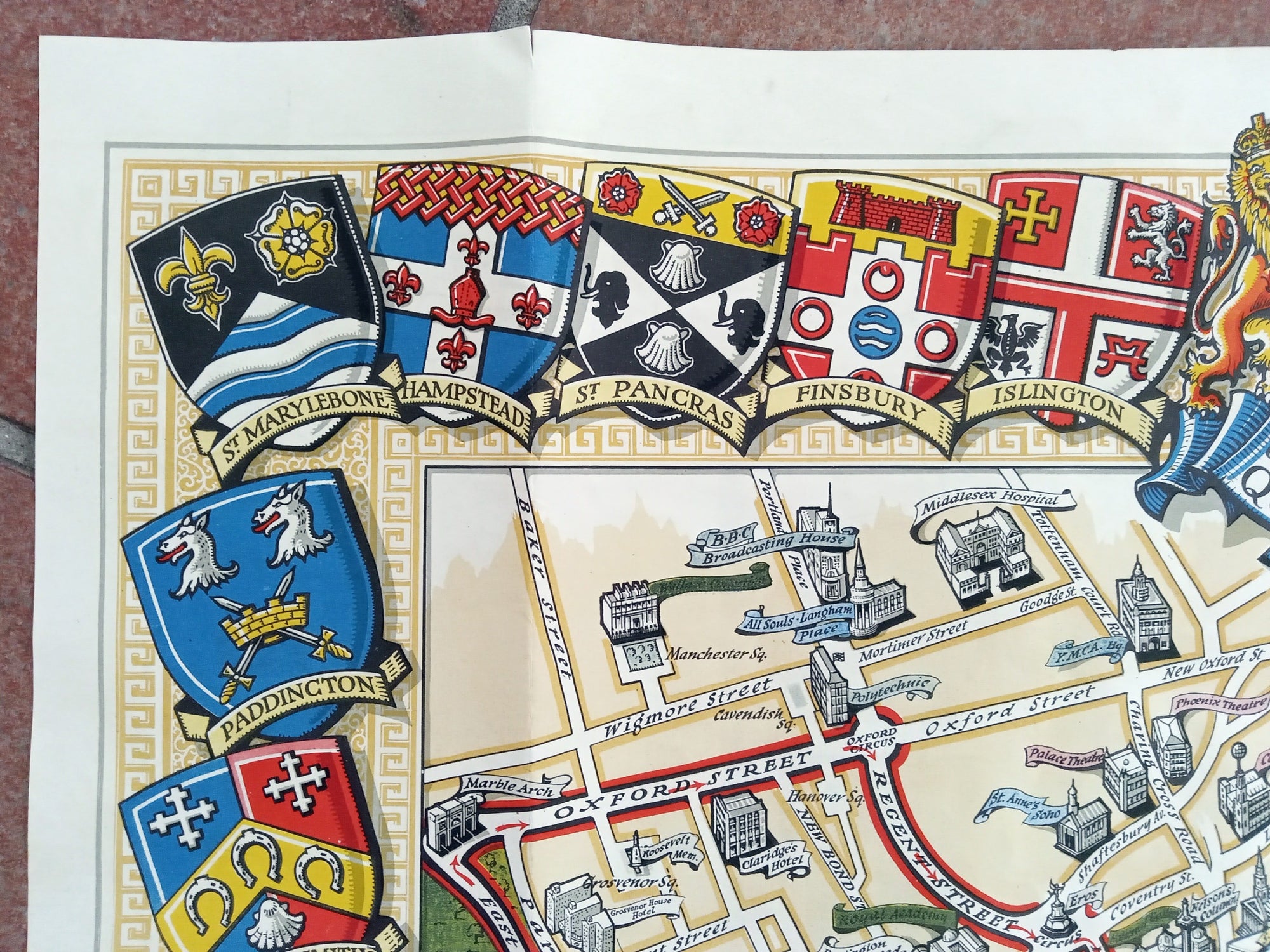
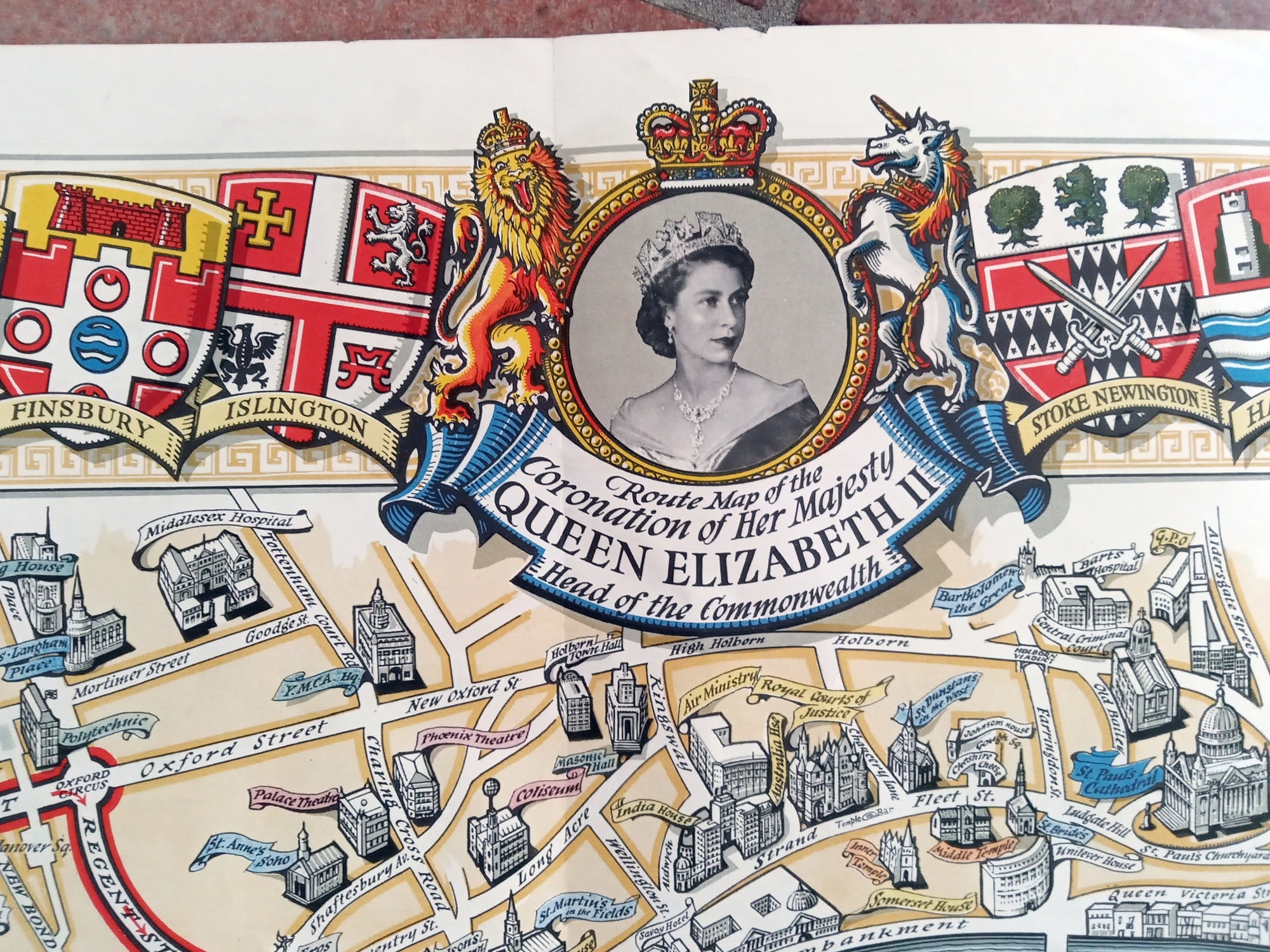
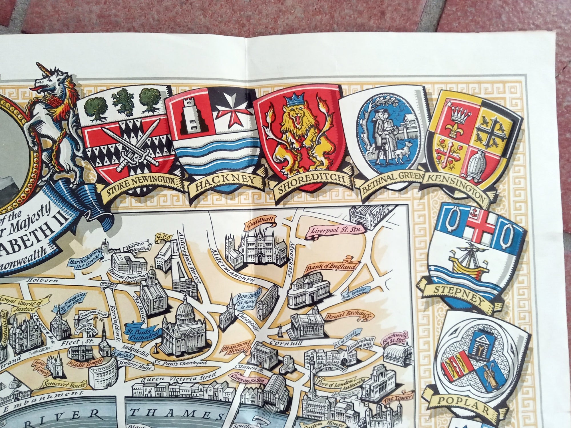
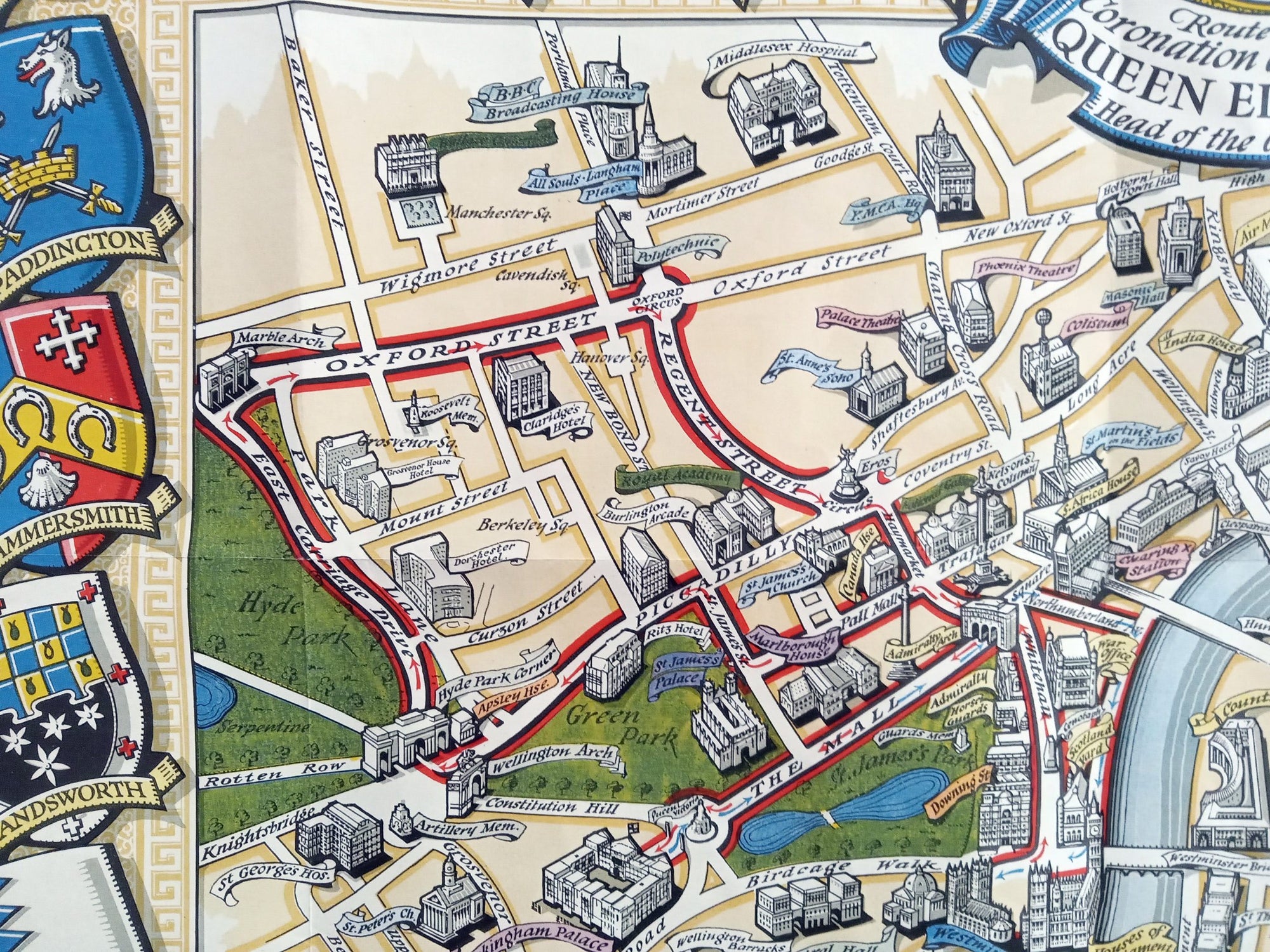
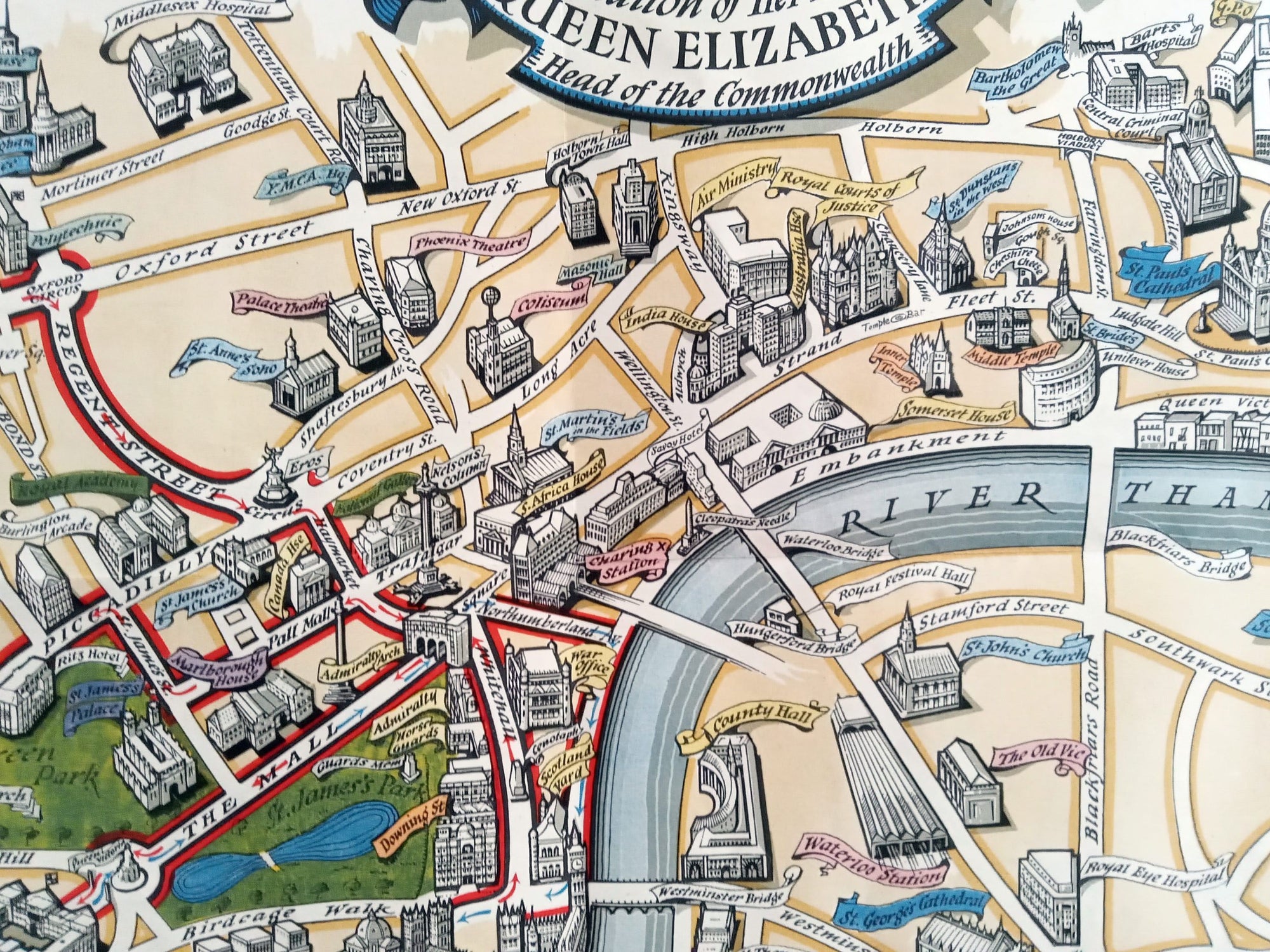
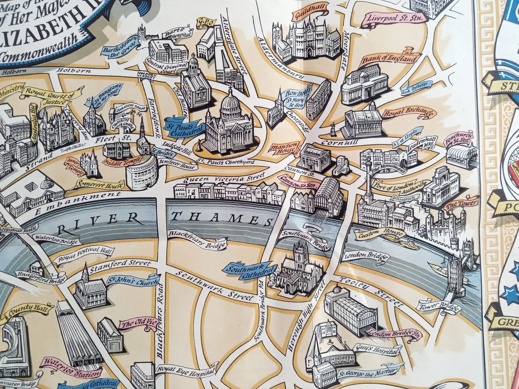
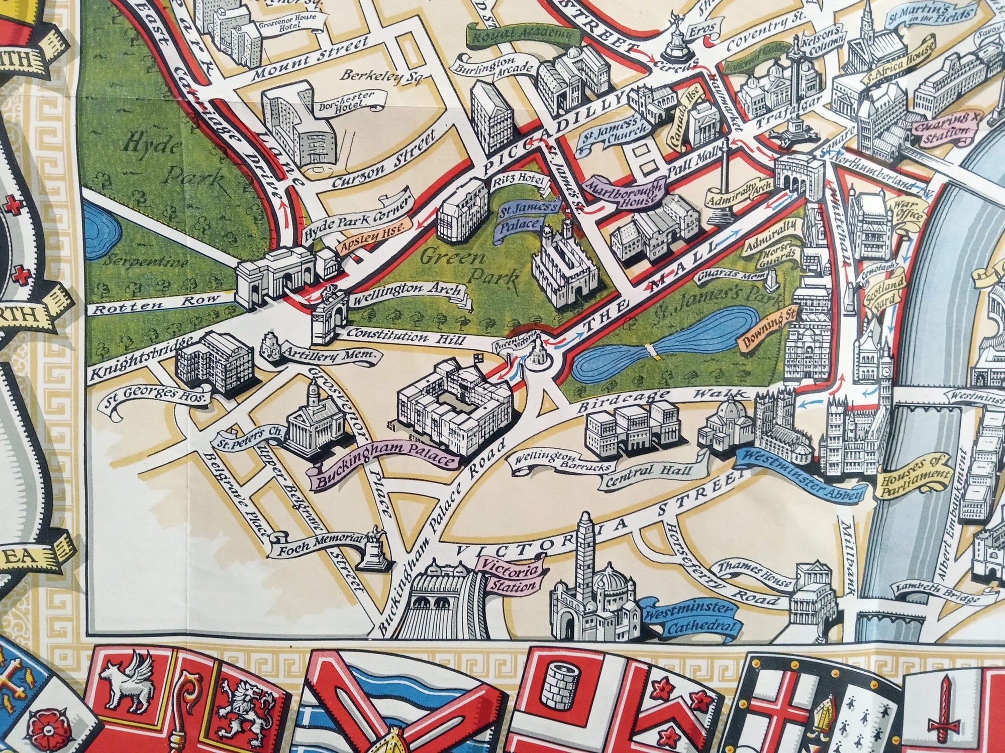
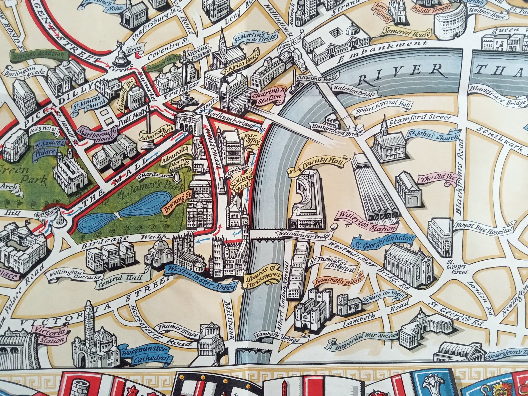
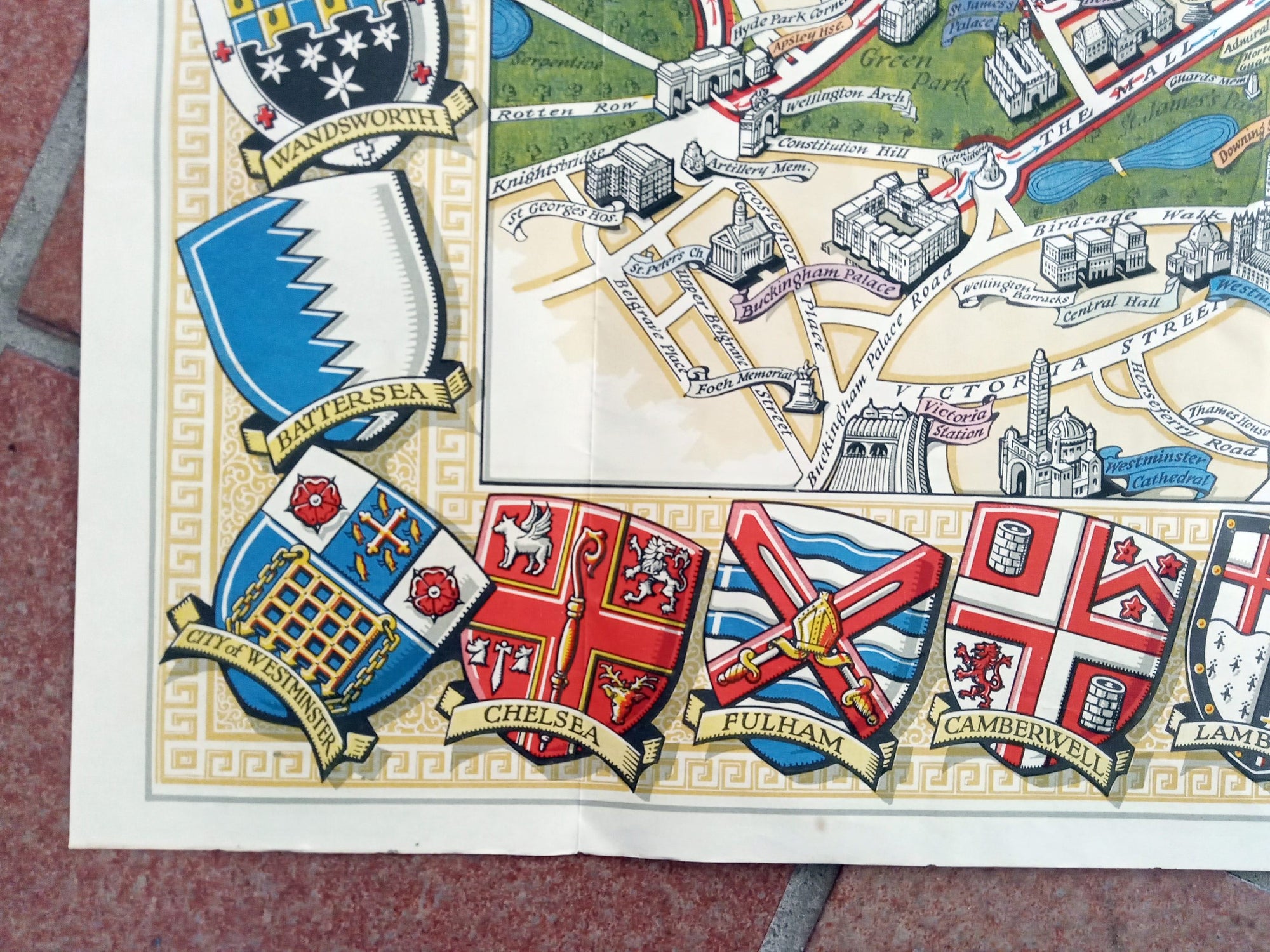
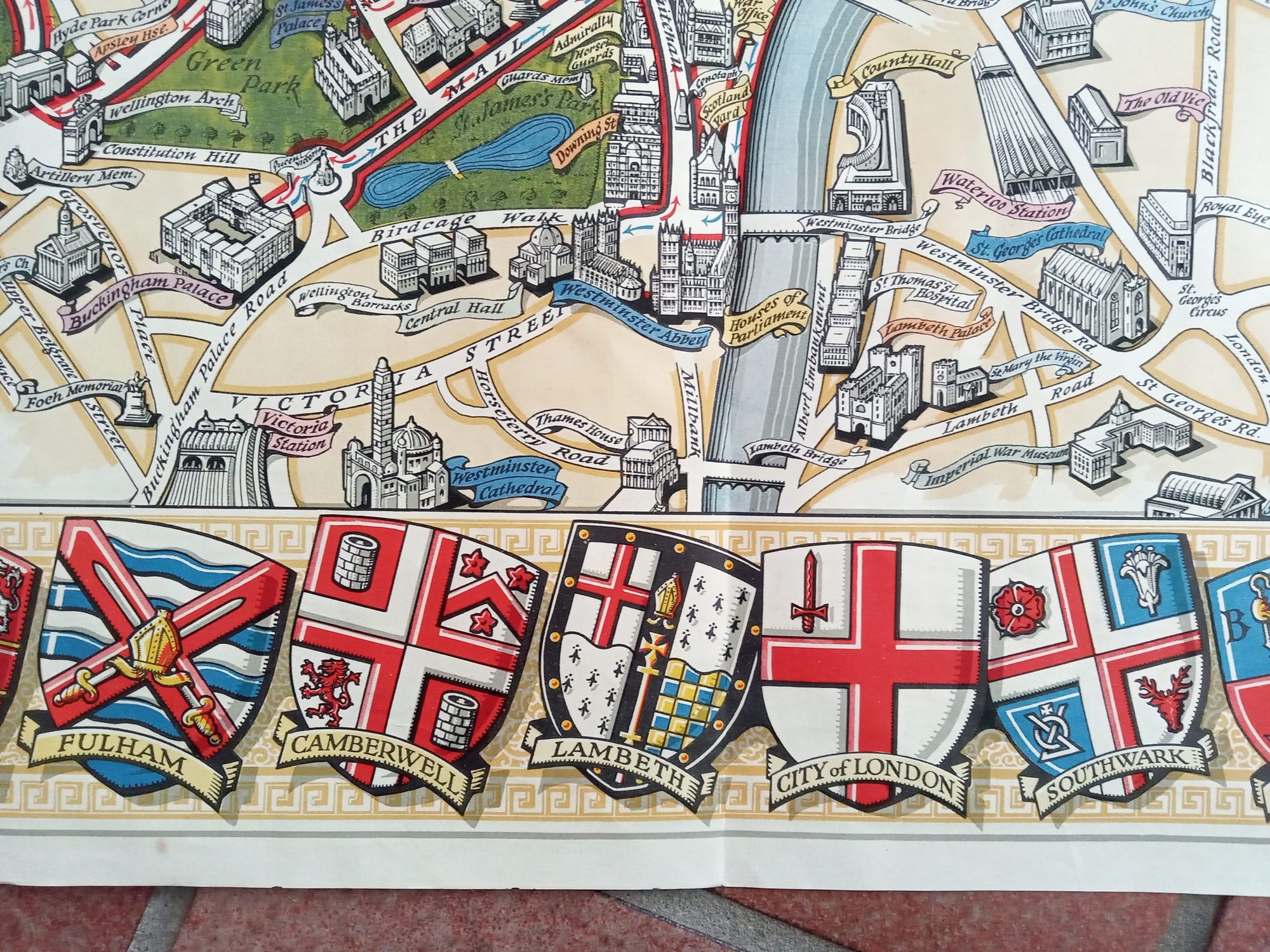
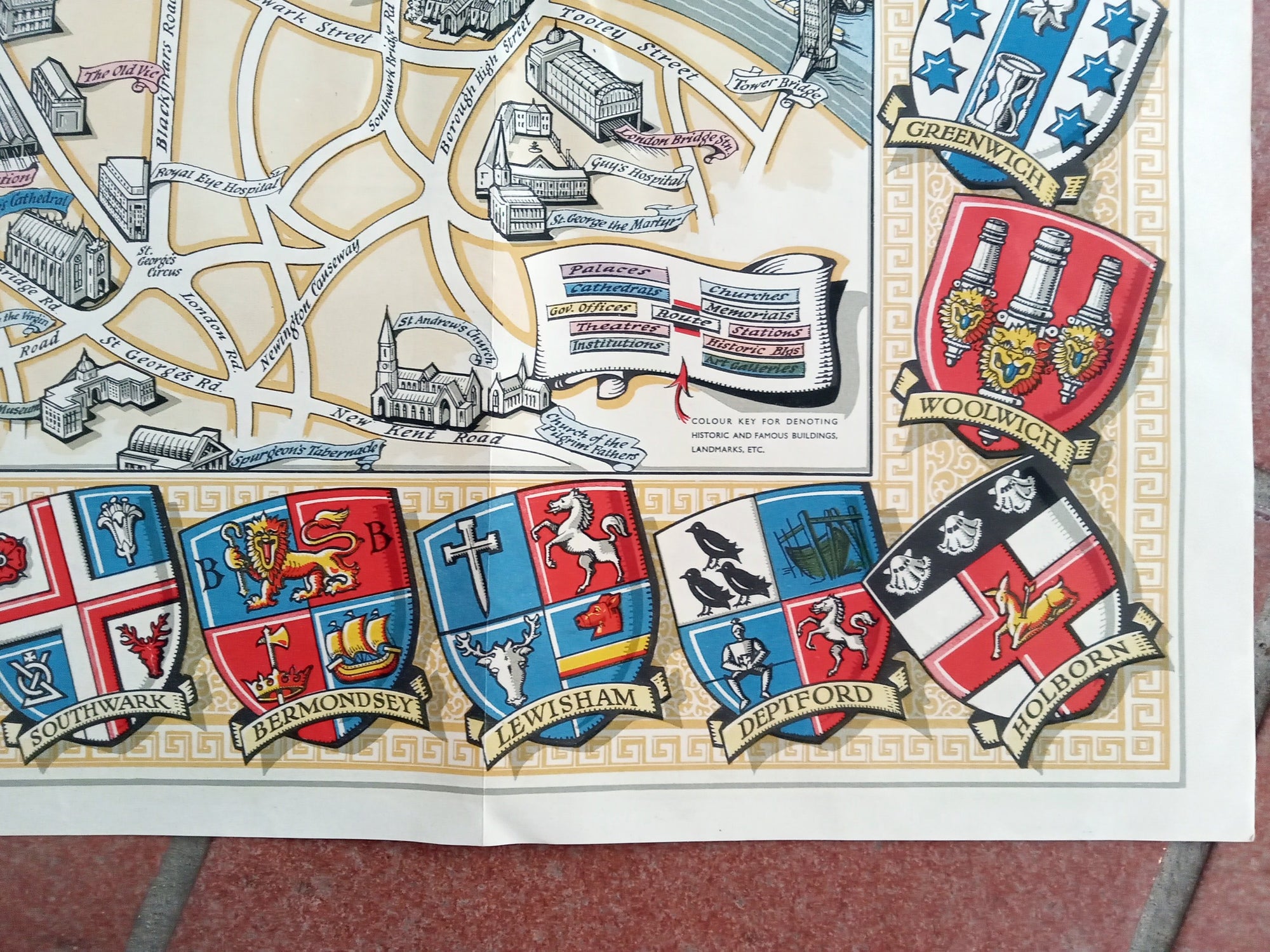
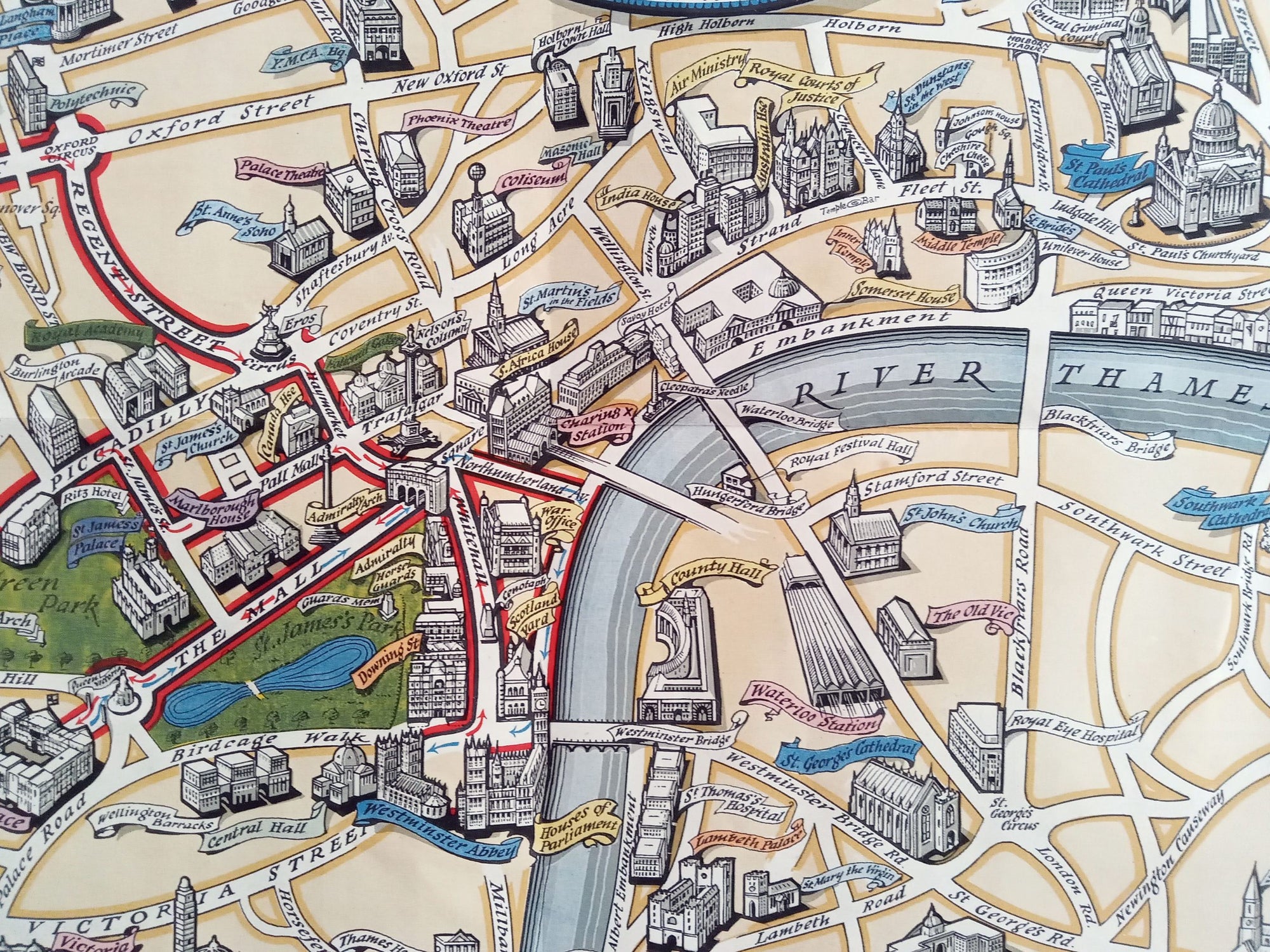
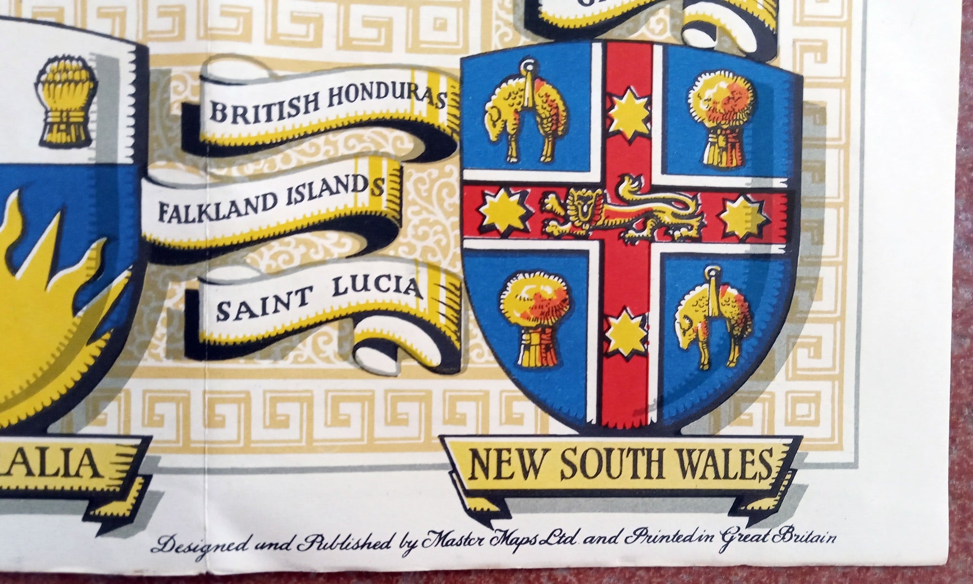
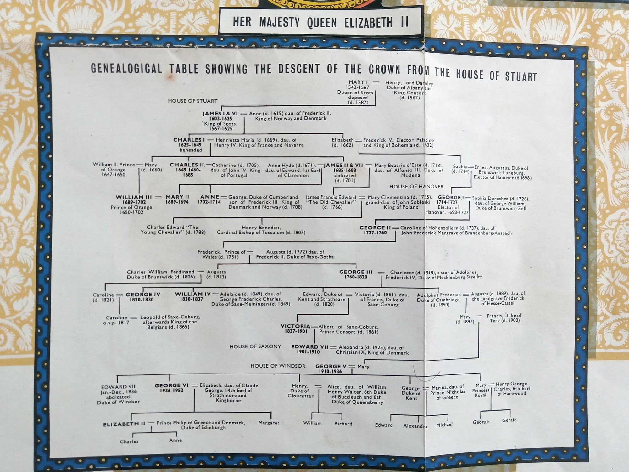
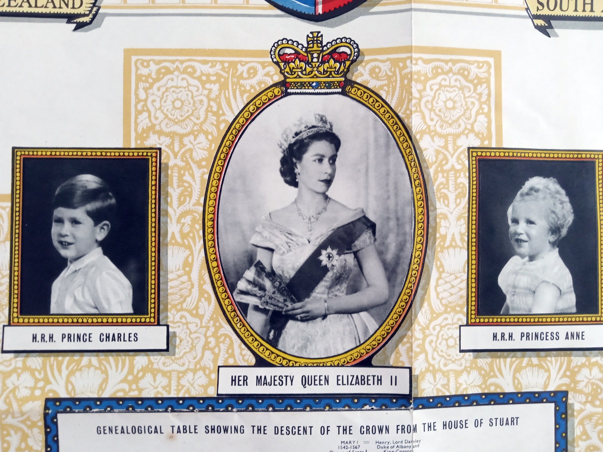
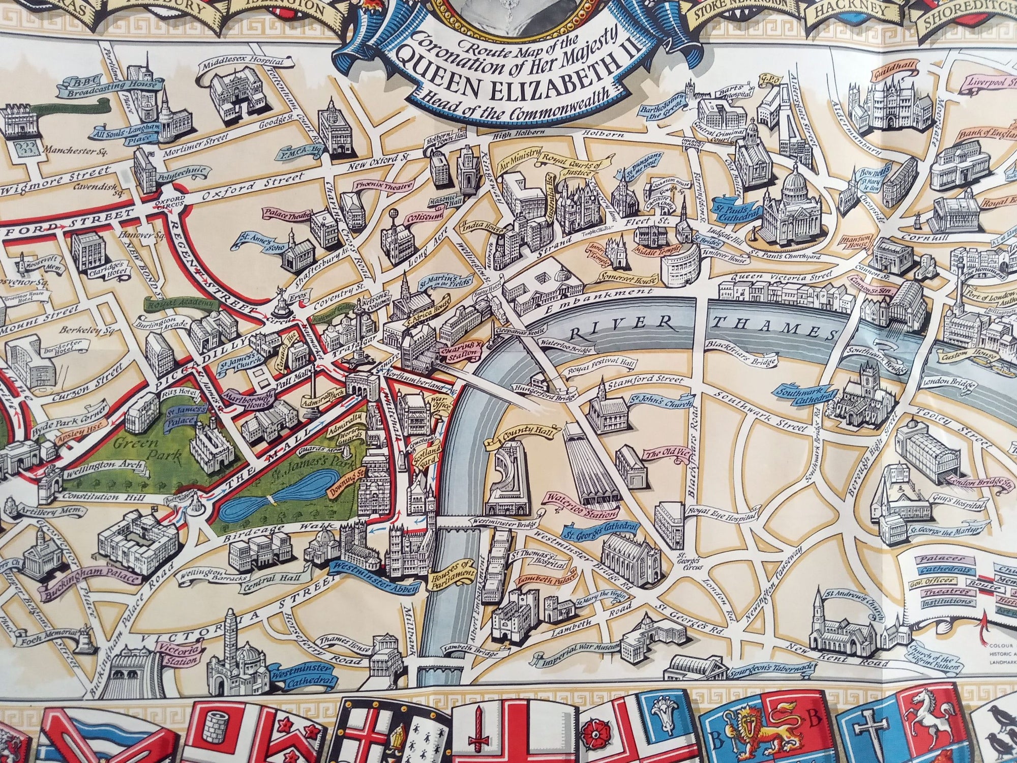
1953 Historic Queen Elizabeth II Royal Coronation Route London Pictorial Map.1953 Historic & Educational Pictorial Map of the Coronation of Her Majesty Queen Elizabeth II Head of the Commonwealth.The reverse side of the map is printed and shows the genealogical royal family tree. This can be seen in the second photo. Comes with the original slip cover which is shown in the 3rd and 4th photos.DATE PRINTED: 1953SIZE: The full page unfolded is approx. 29.75 x 20 inchesCONDITION: Folds in the page as issued..For a folding map of its age I consider it to be in excellent condition. There are about 3 pin holes on the center/horizontal fold and a couple of marginal edge tears very small which can be seen. These are all as normal and i consider very minor in a folding maps of this age. A better copy would be harder to find. The slip cover exhibits minor wear but still in good condition for its age... Please study the detailed photos for condition before purchasing. Thank you...Shipping: Will be shipped folded with a stiffener in a rigid envelope with tracking