Welcome to The Old Map Shop!
Continue Shopping
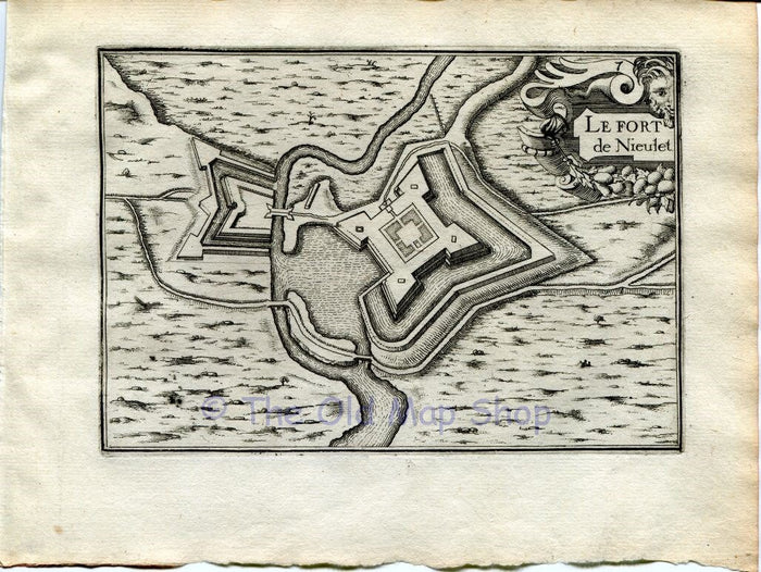
This rare antique 1634 Nicolas Tassin Map Le Fort de Nieulet, Calais France is from Nicolas Tassin’s Les Plans et Profiles De Toutes Les Principales Villes et Lieux Considerables de France.
DATE PRINTED: 1634 so is over 370+ years old.
SIZE: Map area approx 15 x 10.5 cm's on a page 19.5 x 15 cm's.
CONDITION: Very good for its age. I would consider a better copy almost impossible to find. This is the first edition so is a strong impression. The reverse side of page is blank.
ADDITIONAL COMMENTS: Please note that this is a rare antique map by Nicolas Tassin & was actually printed in 1634. This is not a modern reproduction.
STOCK CODE: TassinUNC-010
Thank you.